Maps

Diagram showing with coloured lines the composition of various layers of snow.
Vertical section of the snow on the summit of the Col de Valpelline. .
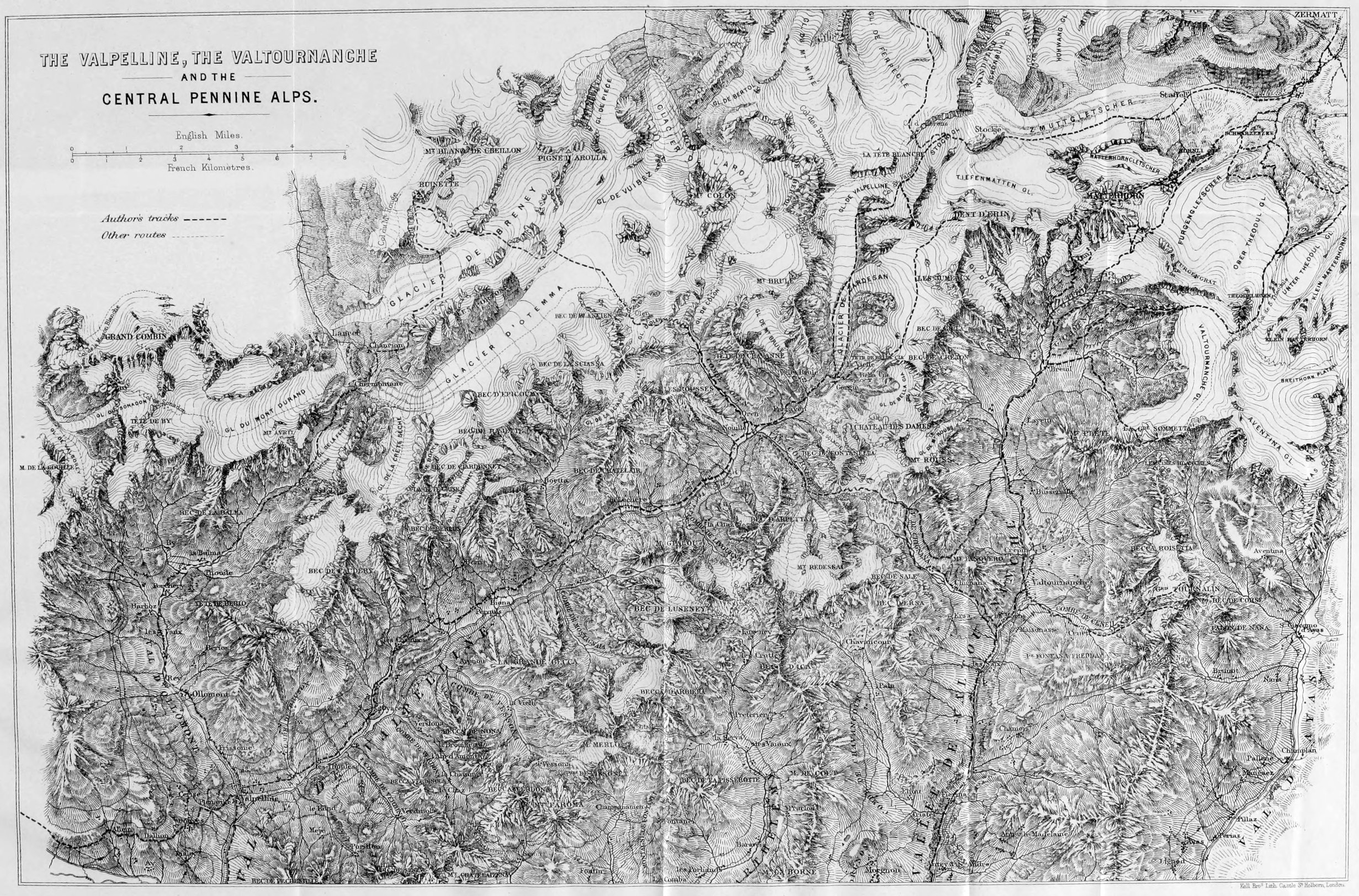
Scale one inch to a foot.
Map showing the mountains discussed in the book, along with towns, locations, and the routes followed by the author.
General route map.
Map of the area around the Valley of Zermatt and the Central Pennine Alps. Zermatt is surrounded by peaks. Dotted lines indicate the routes followed by the author.
The Valley of Zermatt, and the Central Pennine Alps.
Map of the area around Valpelline, Valtournanche, and the Central Pennine Alps. Dotted lines indicate the routes followed by the author.
The Valpelline, the Valtournanche, and the Central Pennine Alps.
Map of the area around the chain of Mont Blanc, from Chamounix in the north to Courmayeur in the south. Dotted lines indicate the routes followed by the author.
The chain of Mont Blanc.
Coloured closeup map of the Matterhorn, showing the surrounding gletschers, the Hörnli ridge, and the routes followed by the author.
The Matterhorn and its glaciers.